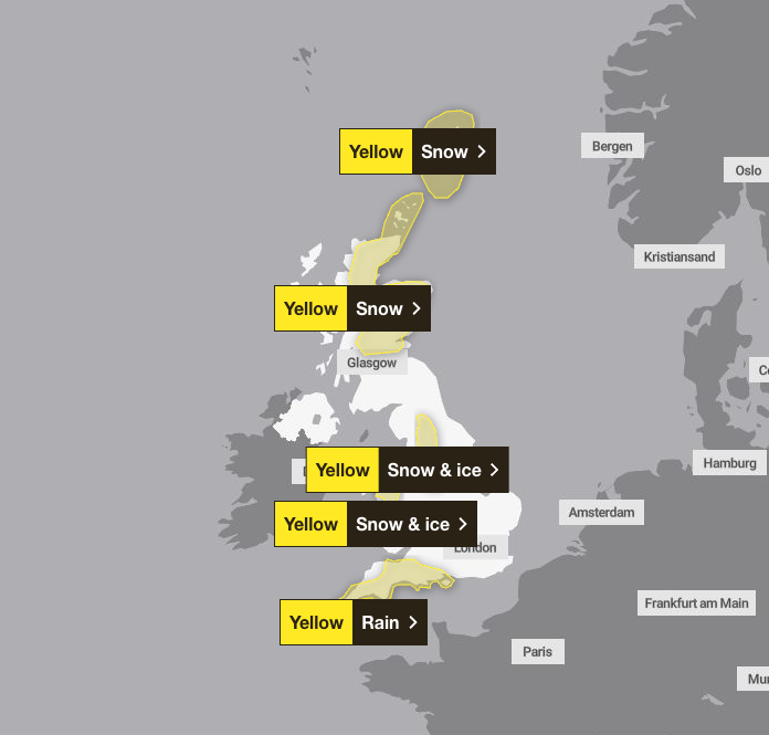
Snow and rain expected to hit UK as Met Office issues weather warnings

Parts of the UK will be hit with snow and heavy rain days after Storm Chandra; Yellow weather warnings will be issued in Scotland, England and Wales.
The Met Office warned that further adverse weather could lead to some flooding and disruption, while fast-flowing or deep floodwaters could be life-threatening.
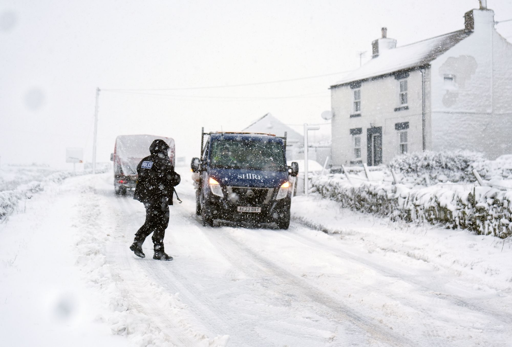
Two weather warnings have been issued for snow and ice in north Wales and parts of the Midlands and north-east.
Residents in Cumbria, Greater Manchester and Lancashire can expect to see sleet and snow; Up to 3cm of snow may be possible in higher elevations.
Driving conditions can become hazardous, and commuters are encouraged to carry essential supplies such as ice scrapers and warm clothing in their cars.
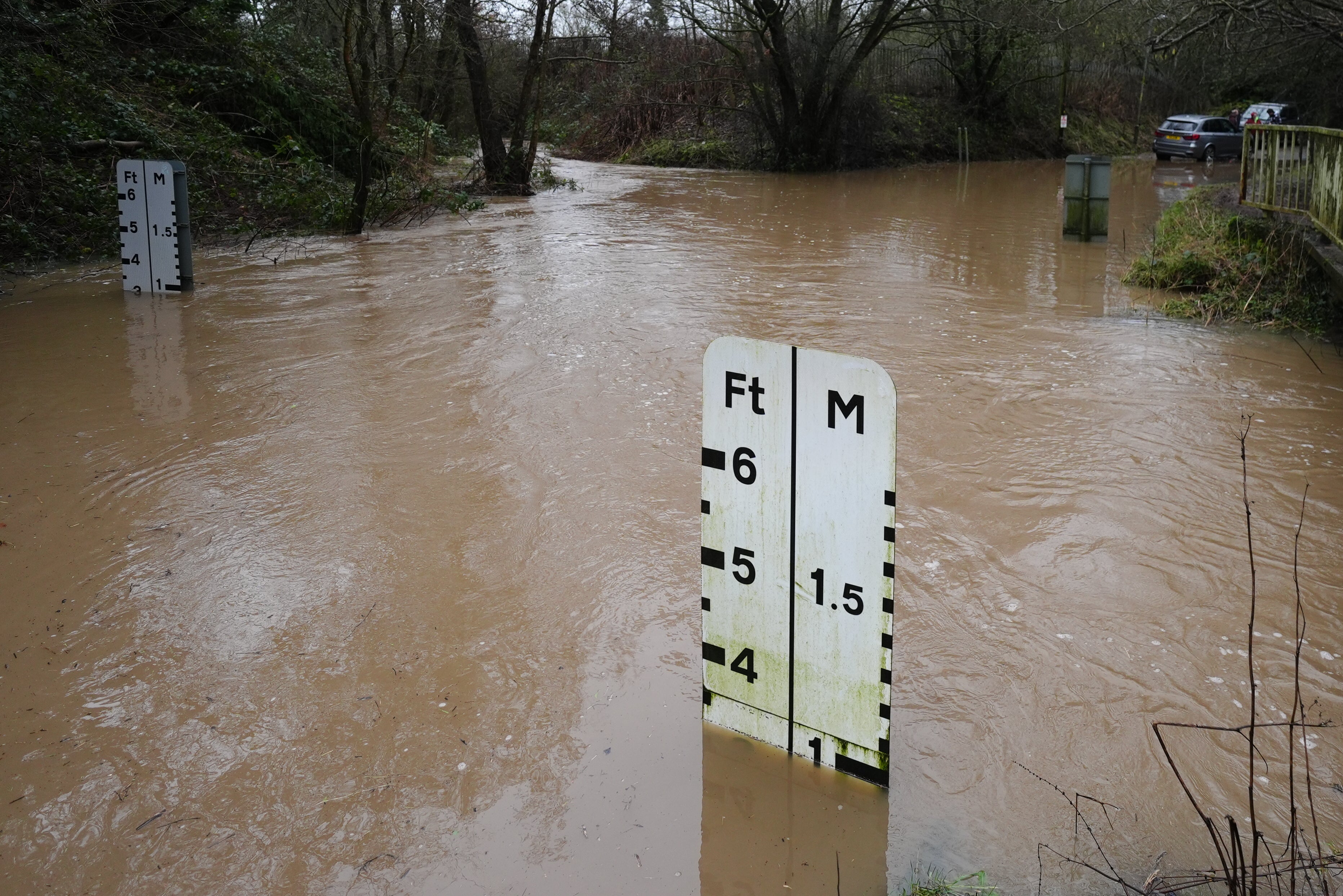
A yellow warning is in effect across Cornwall and Devon until 9pm on Tuesday; Train and bus cancellations and delays are expected.
Great Western Railway apologized for the disruption and warned that all services between Exeter St Davids, Barnstable and Crediton were suspended due to floodwaters and would not reopen until Wednesday.
Two yellow weather warnings have also been issued in Scotland, covering the North East, Highlands and Fife.
An alert extends north from Stirling and covers Perth, Aviemore, Inverness, Fife and the Highlands, and extends to the Orkney Islands.
It will come into force at midnight on Tuesday and remain in effect until 15:00 on Wednesday. A separate warning will be issued for the Shetland Islands, coming into force at 6pm on Tuesday and remaining until the end of Wednesday.
The West and North West of the country were not affected by the warnings.
The Scottish Environment Protection Agency (Sepa) has a flood warning for the Churchill Barriers area in the Orkney Islands.
Ferry operator CalMac has issued yellow and amber warnings about the disruption and cancellation of many of its services.
It comes after the latest figures showed an “extraordinary” amount of rain that led to last month being the second wettest January on record in Northern Ireland and the sixth wettest January in Southern England.
Northern Ireland received 70 per cent more rainfall than the long-term average, with 195.6mm falling during the month, according to provisional data from the Met Office.
This was enough to make it the wettest January since 1877, when 197.1 mm was measured, and the second wettest since comparable records began in 1836.
Southern England saw 74 per cent more rainfall than normal for the month; The rainfall amount of 136.8 mm was enough to make this region the sixth wettest region in the region.
Overall, the UK was the 15th wettest country with 124.2mm, an increase of 50 per cent above average.
Three named storms (Goretti, Ingrid and Chandra) brought torrential rains in many areas, leading to flooding and widespread travel disruption.
Met Office’s five-day weather forecast
Tuesday
The rain, which continues in the south in the morning, is slowly moving towards the north. Rain and snow will continue in the hills of north-east Scotland. Cloudy but mostly dry between these systems. Skies will be clearer in the South West with heavy showers possible later.
tuesday night
The rain continues to move northwards, turning to snow over the high hills of Wales, the Pennines and eastern Scotland. It is windy and quite cold in the north. Showers further south.
Wednesday
Rain and snow on the hills remain confined to the North while it is still windy in the North East. Drier further south with slightly brighter spells. Temperatures are mild here and cold in the north.
View from Thursday to Saturday
Unrest continues throughout the week due to new cloud and rain outbreaks. Later, short periods of bright weather are expected in the northern parts where more snowfall is expected on the hills.


