Weather phenomenon that led to ‘Beast from the East’ returning to UK this winter

The UK could face a new spell of cold weather, with the weather phenomenon that brought the ‘Beast from the East’ in 2018 set to have “significant impacts” on the country’s weather.
The Met Office said “winter has arrived early across the UK, bringing cold Arctic air and complex weather hazards” following a week of ice and snow warnings across parts of the UK.
Temperatures will rise this weekend as milder, more unstable, Atlantic-based weather arrives with clouds, rain and winds, but a sudden stratospheric warming (SSW) event next week could see cooler weather return within the next two weeks.
An SSW involves a rapid increase in temperature in the stratosphere above the Arctic, often leading to a reversal of stratospheric polar vortex winds and a rapid descent of cold air.
This increases the chance of colder weather in the UK 10 to 14 days later by roughly 70 per cent, according to the forecaster. While there are no guarantees, meteorologists will be keeping a close eye on weather events that could lead to a colder-than-average start to the winter season.
“The country is experiencing a wide range of conditions, from the collision of Arctic and North African air masses to the effects of heavy rain, flooding and significant snowfall,” the forecaster said. “Regional differences are stark, with some regions facing heavy snowfall while others enjoy sunny skies and cold nights. The outlook remains uncertain with the potential for more cold spells and unstable weather as the season progresses.”
SSW was the same weather event that gave rise to the brutal ‘Beast from the East’ in 2018, which brought cold air from Siberia to Europe and heavy snowfall to Great Britain and Ireland. Temperatures dropped to -14.7C across the country in Faversham, Kent, with Storm Emma bringing 50cm of snow in some higher areas.
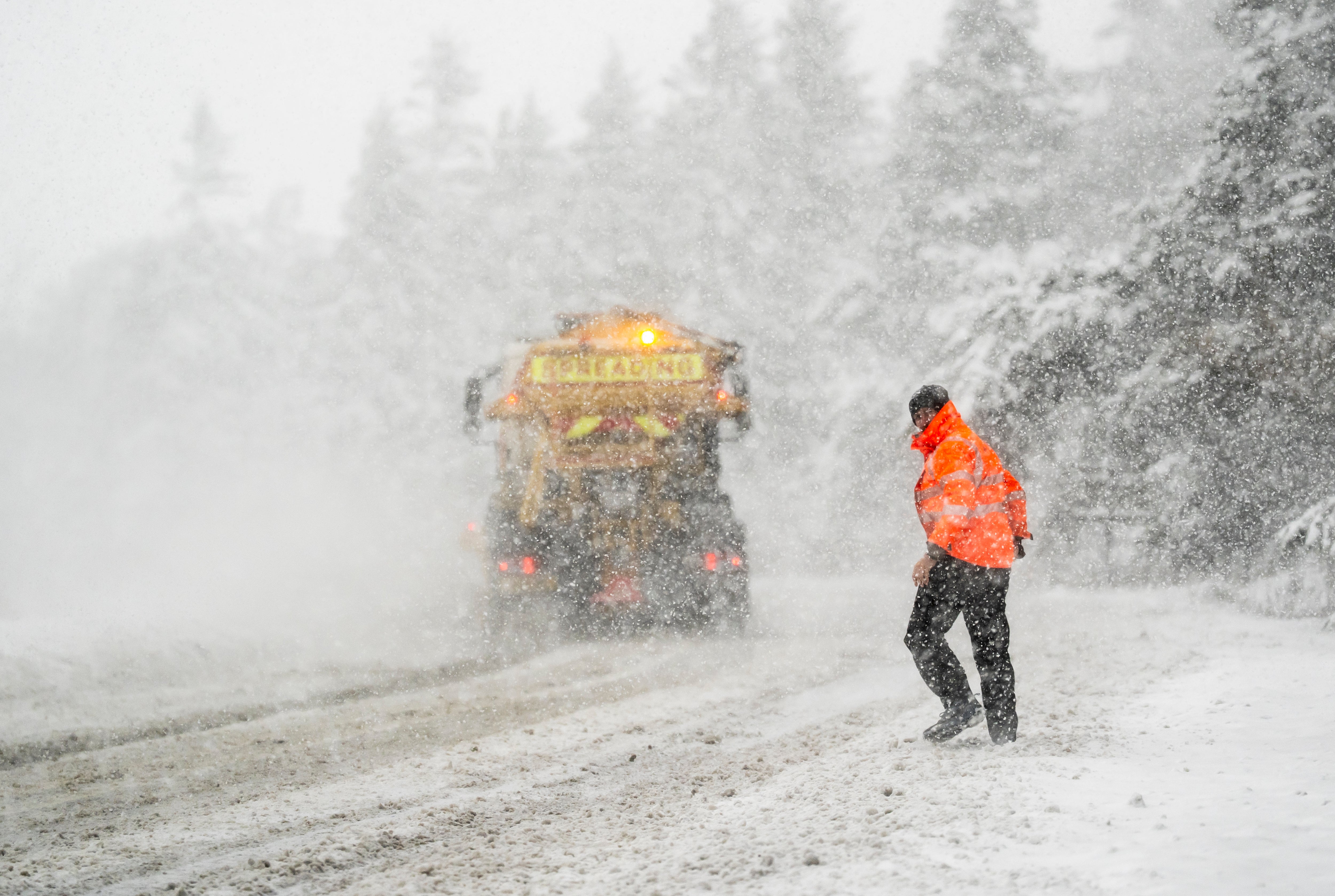
Temperatures across the country this week have fallen well below average for this time of year, with wind chill making the air feel even colder, with temperatures generally reaching minus one or minus two degrees. The Met Office recorded low temperatures of -11.7C at Loch Glascarnoch on Thursday night, the coldest night of the season so far.
A recent arctic airmass brought snow to the UK this week as schools were forced to close across the country, and yellow and amber ice and snow weather warnings have been issued for parts of the UK.
MET OFFICE VIEW
Saturday:
Cloudy, wet and windy weather will move eastwards across England and Wales. Scotland and Northern Ireland will be brighter with sunshine and showers, and brighter skies will then reach the north and west of England and Wales. Temperatures approached normal.
The rain is slowly clearing across central and south-east England. Although heavy rain and strong winds are coming from the west, showers are more evident in other places. Some fog and some frost in the north.
Sunday:
Wind and rain will slow in the west over Northern Ireland, northern England and southern Scotland, moving north and east. Brighter, showerier in the far north and increasingly south.
From Monday to Wednesday:
Heavy rain on Monday, especially in the central and eastern parts. Feeling cold again in strong winds. Drier and brighter on Tuesday as the winds ease. It will rain mid-week, but it will ease.


