Met Office warns gale-force winds to hit UK as cold snap returns

Snow and high winds could return in England this week, with the Met Office predicting a drop in temperatures.
There are several weather warnings on Thursday, with wind gusts as strong as 70 mph possible.
After a rainy start to the year, the country has seen brighter weather in recent days and warmer weather has arrived with the start of March. Last Thursday was the hottest day of the year so far, with sunshine bringing temperatures to 19.2C.
The highest temperature was recorded in Northolt, London, surpassing the warmest day of the year at 18.7 degrees recorded at Kew Gardens the previous week.

This meant that parts of the UK were warmer than Barcelona, with the Spanish city’s top temperature being 16C.
However, the upcoming weather is expected to be a bit drearier, with rain, wind and clouds across the UK.
According to the latest forecast from the Met Office, cloudy and windy weather is expected for the rest of this week before the possibility of some snowfall in the Scottish highlands.
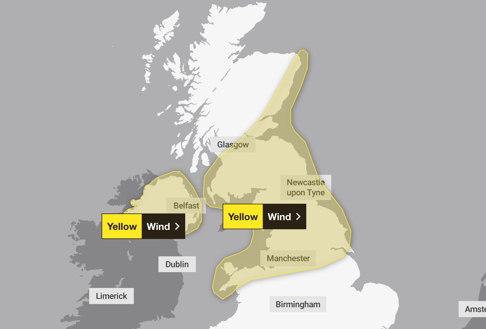
Strong winds are expected from 5am on Thursday until 8pm in parts of Scotland, the north of England and the Midlands, Wales and Yorkshire. According to the yellow weather warning, winds of 50 to 55 mph are expected across the UK in conjunction with an active weather front moving south-eastwards.
Some coastal areas and high wind areas are experiencing wind gusts of 60 mph or even 70 mph in a few places. The wind will ease from the north throughout the day.
Northern Ireland will also experience southwesterly winds, with gusts expected to be between 40 and 50 miles per hour expected across much of the country on Thursday morning. There is the potential for many areas to see a brief period where wind gusts could reach 50 to 60 miles per hour accompanied by heavy rain. After the warning ends, the winds will blow from the west around 12:00.

Rain and wintry conditions are expected from Thursday onwards, with temperatures dropping on Friday compared to those felt in recent days. The forecaster said peak temperatures of 7 to 9 degrees are slightly below what Brits have experienced in the last few days, and strong winds will make it feel more like 1 to 5 degrees.
Jason Kelly, the Met Office’s chief operational meteorologist, added: “A noticeable change in wind direction to the north-west will bring a noticeably colder day across the country on Friday, with the potential for sunny spells, heavy showers, coastal storms and a mix of snow at higher elevations.
“There is also the possibility of accumulation in the lower hills. The picture will become clearer as time approaches, so follow our forecasts as the week progresses.”
Met Office’s latest forecast
Today:
Heavy rain is blowing south-eastwards over Scotland and Northern Ireland this morning, reaching northern and western England and Wales this afternoon. Brighter, but with some rain in the Southeast. It gets brighter, wetter and colder towards the north. Windy, sometimes stormy.
Tonight:
Heavy rain is falling in south-east England and Wales tonight. Otherwise clear skies and showers, some like winter. More persistent rain and snow in the North, where there is patchy frost and ice. Windy.
Friday:
A cold and windy day with a mix of sunshine and showers. Heavy rains will combine to create more permanent rain and snowfall in places; The snow will most likely be over the hills.
Outlook from Saturday to Monday:
Very cold starting from Saturday, then sunny and sometimes wintery with intermittent showers. Lighter winds. Then it will rain on Sunday. Some hill snow. More rain will fall in the West on Monday. It’s windier again.


