Pan Am wreckage found off Puerto Rico over 70 years after deadly crash

NEWYou can now listen to Fox News articles!
Wreckage from a Pan Am plane that crashed into the ocean off the coast of Puerto Rico in 1952, killing 52 people and prompting mandatory passenger safety briefings on commercial flights, has been found.
Researchers recently found the wreckage of the DC-4 by using an autonomous underwater vehicle equipped with high-resolution sonar to locate the fuselage and detached tail in approximately 2,000 feet of water.
The Clipper Endeavor plane made a hard landing in the ocean after losing engine power shortly after taking off from San Juan, Puerto Rico, en route to New York City.
The 17 surviving passengers and crew told investigators that everyone survived the landing, but many passengers had difficulty finding life jackets and the crew had difficulty removing life rafts. The plane sank within minutes.
FLIGHT ATTENDANTS PLEAD PASSENGERS TO STOP DOING WHAT MAKES THE CREW MOST COMFORTABLE
The Clipper Endeavor plane made a hard landing in the ocean after losing engine power shortly after taking off from San Juan, Puerto Rico, en route to New York City. (Pan Am Historical Foundation via AP)
The Civil Aeronautics Board attributed the crash to inadequate maintenance, which contributed to the engine failure, and the captain’s failure to control the aircraft after loss of power.
Panic experienced by passengers trying to grab flotation devices helped spur aviation safety reforms, including mandatory pre-flight passenger briefings and improvements to flotation equipment.
The crash first came to the attention of Air/Sea Heritage Foundation President Russ Matthews when he heard about the luggage tag of the plane that washed ashore in Florida in 2019 and started digging deeper.
This led to years of scouring Pan Am and Coast Guard archives for clues about the location of the plane’s wreckage. Reports from the Civil Aeronautics Board, which precedes the Federal Aviation Administration, also helped in the search.
TRAVELERS REVISIT THE GOLDEN AGE OF FLYING AS NOSTALGIC COLLECTIBLE ITEMS MAKE A MAJOR RETURN
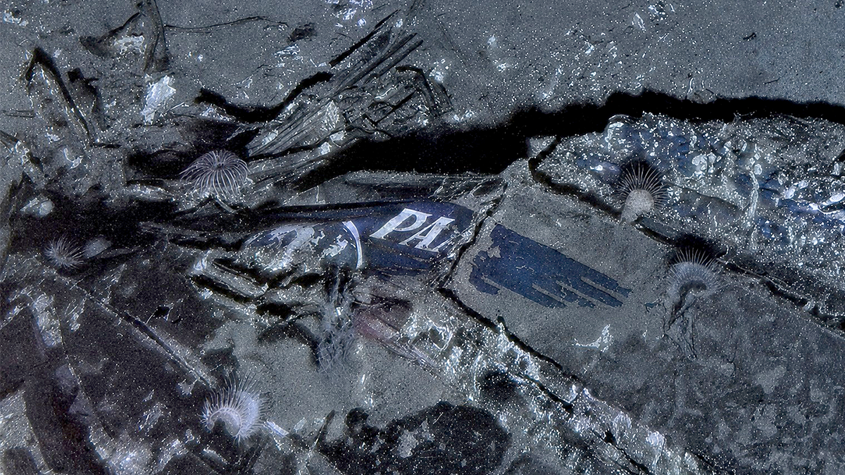
Pan American World Airways logo on the nose of the Clipper Endeavor wreck. (Deep Sea Vision via Air/Sea Heritage Foundation and AP)
But the key to the discovery of the wreckage was found in records of a hearing into the crash held in Puerto Rico and a map that predicted the crash site because the Air Force pilots who witnessed the crash were in the area during a training flight.
Bad weather disrupted a previous attempt to find the wreckage with a sonar device taken two years ago. Matthews said he and his volunteers want to make a second attempt to locate the plane before the 75th anniversary of the crash next year with a newer, more advanced drone designed for military purposes such as finding submarine mines.
Tony Romeo, CEO of undersea research firm Deep Sea Vision, had been talking to Matthews for some time about the possibility of helping find the plane if one of his ships was in the area. Then in April, one of the company’s ships was passing through Puerto Rico between two other jobs while carrying an advanced underwater drone with the right sensors to locate the plane.
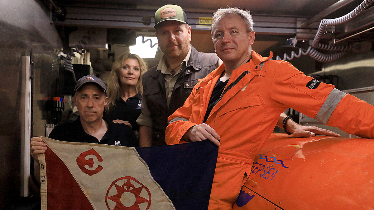
Air/Sea Heritage Foundation (ASHF) President Russ Matthews, ASHF Director Idee Matthews-Montijo, Expedition Unknown’s Josh Gates and Deep Sea Vision Head of Operations Craig Wallace in an AUV hangar flying the Explorers Club flag. (Discovery Channel via AP)
CLICK TO DOWNLOAD FOX NEWS APPLICATION
“We were there and at that moment everything came together: good weather, the right crew, the right equipment and ship. So we tried it,” said Romeo, whose father is a mechanic and pilot for Pan Am.
Deep Sea Vision previously conducted an unsuccessful six-month mission to search for Amelia Earhart’s plane.
All of the research conducted by Matthews’ group, along with weather data from the time of the accident, was synthesized to develop a map of the most likely location and a search area of 10 square nautical miles. The drone located the debris on its first pass through the area, but searchers were unaware until the debris returned to the surface with images.
The Associated Press contributed to this report.