UK weather map: Where heavy rain is expected to hit after Storm Chandra flooding

Storm Chandra has caused weather chaos this week as strong winds, heavy rain and snow lashed much of the UK, with the Met Office issuing yellow warnings until Saturday.
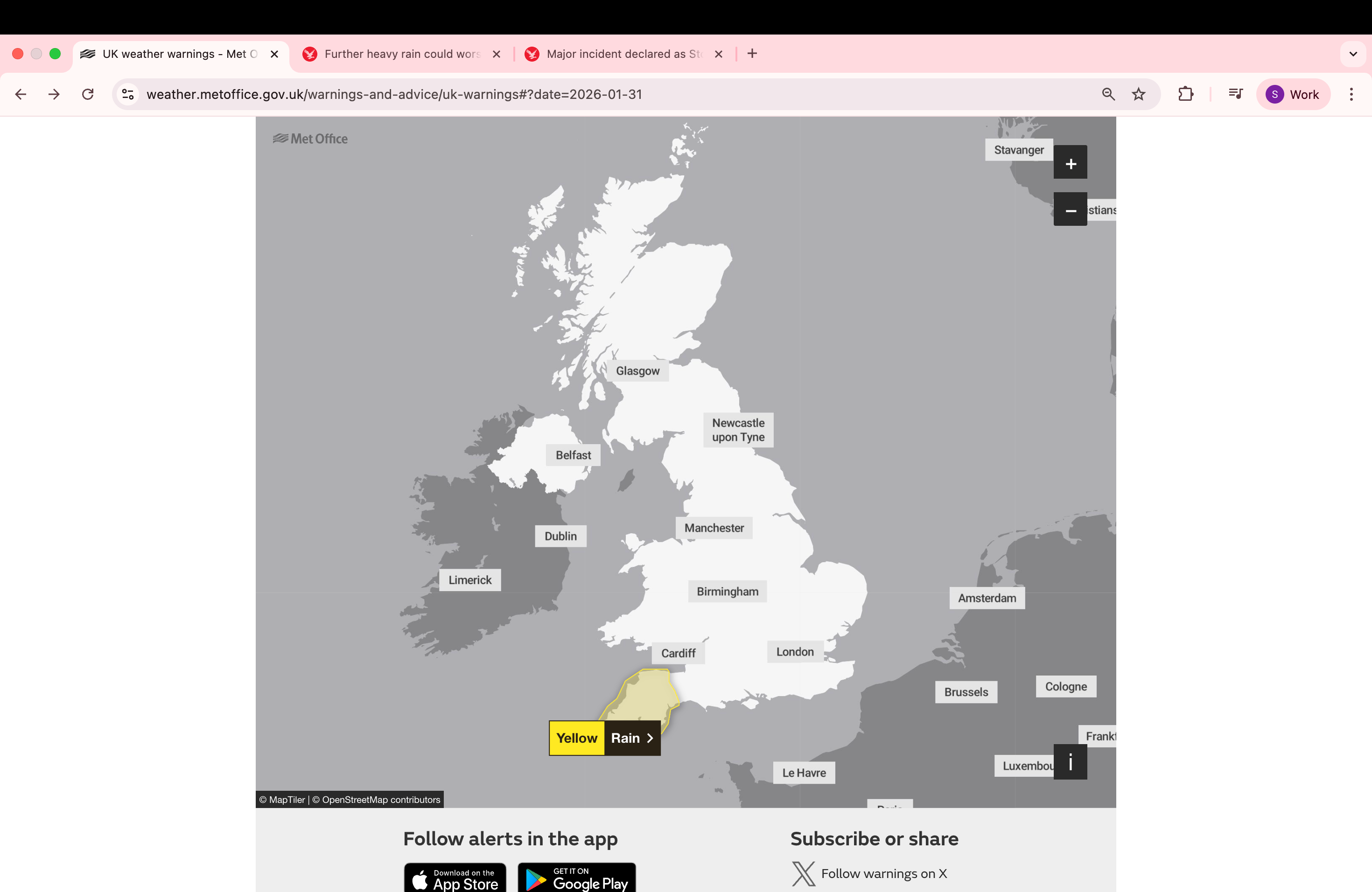
The Met Office has issued a yellow weather warning for rain in south-west England from 9am on Friday, which is due to end at 6am on Saturday morning. A further weather warning has been issued for parts of Northern Ireland from 12pm on Friday until 6pm on Friday evening.
While dozens of flood warnings remain in place across the UK, a major incident has also been declared in Somerset as a result of disruption caused by rainfall earlier in the week.
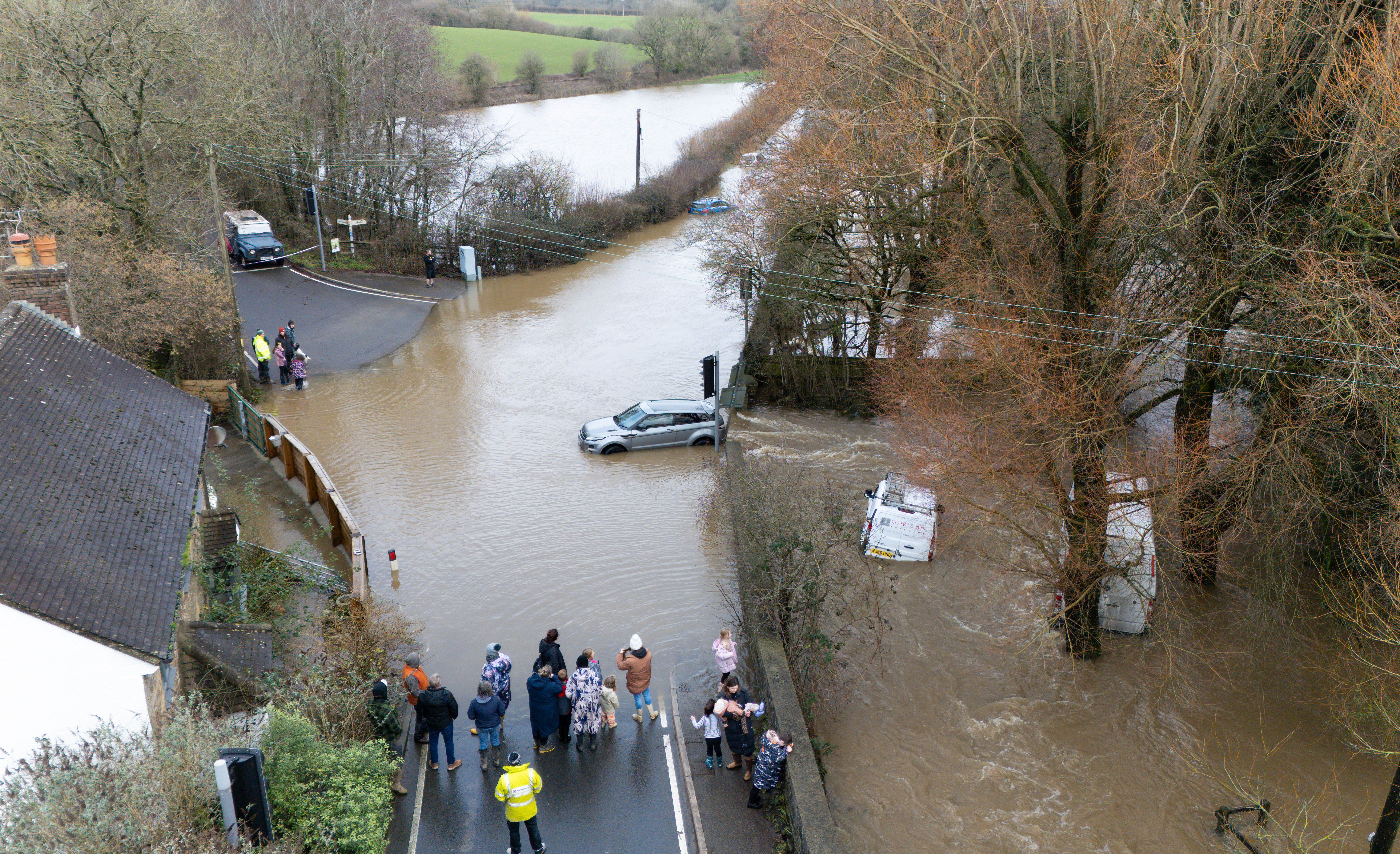
Storm Chandra has already broken several new daily rainfall records for January. Earlier this week, a lorry driver died after crashing into a river in the New Forest on Tuesday following Storm Chandra.
Longer journey times and cancellations are expected to affect road, rail, air and ferry services, as well as causing some roads and bridges to close during weather warnings.
The Met Office said: “Heavy rain will impact Northern Ireland on Thursday night and Friday. Although the wettest conditions are likely over Antrim and Down, there is the potential for 10-25mm of rainfall in many areas and 40-60mm in some hills. The rain will be accompanied by strong south-easterly winds, particularly on Thursday night and early Friday.”
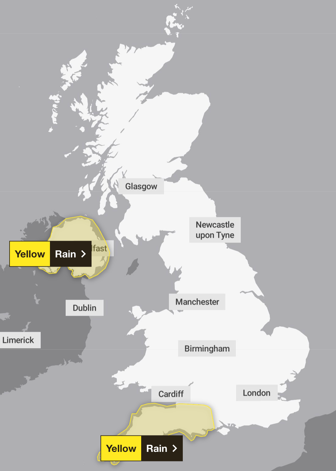
The forecast service added: “Rain is expected to fall, heavy at times, over Cornwall on Friday morning and move north-eastwards across other parts of south-west England in the afternoon, followed by showers overnight on Friday evening and into Saturday morning. Widespread rainfall of 10 to 20mm is expected, with up to 30mm possible across the moors and perhaps in west Cornwall. Falling on saturated ground could cause some flooding and disruption. Strong winds are also likely in places.”
There is a slim chance that homes and businesses in Northern Ireland will be flooded and some communities cut off by flooded roads. The Met Office also warned that power outages and other services being disrupted were unlikely.
The Royal National Lifeboat Institution (RNLI) is warning people to be careful near the coasts of Devon and Cornwall due to the potential for 15ft waves to surge towards exposed beaches and overtop sea fronts and harbor walls.
Saturday’s weather warning will cover the following areas in South West England: Cornwall, Devon, Plymouth, Somerset and Torbay.
Here is the Met Office’s four-day forecast for the UK:
Tonight and tonight:
Mostly cloudy, with light rain in the northern parts and snowfall on the hills. Initially cloudy and mostly dry elsewhere, but wet and windy weather moving southwest will move northeastward overnight. Then the southwest will be clearer and showery. Mostly it does not freeze.
Friday:
Friday looks quite cloudy and windy; The rain moves northward, dropping snow on some of the northern hills. Although it is briefly brighter in the south, heavier rain and strong winds are developing there.
Outlook from Saturday to Monday:
Unrest continues over the weekend and into next week. Heavy or prolonged rains affect most regions, sometimes accompanied by strong winds. Snow continues in the northern hills.


